Sitemap
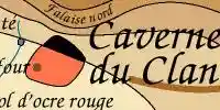
Shanidar Cave in Iraq. The Clan Cave in the EC series is located on the Crimean Peninsula, but the original was located hundreds of kilometres away in Iraq, and is a very important Neanderthal site. The skeletons corresponding to Creb and Iza are from there.
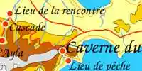
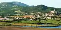
The Clan Fishing site - Sudak on the Crimean coast
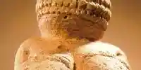
The Venus of Willendorf. This is Jondalar's sculpture of the mother.
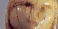
The Venus of Brassempouy. This is the sculpture of Ayla.
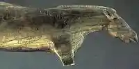
Sculpture of 'Whinney', Ayla's horse.

Golden Thread - Ayla's contraceptive.
Geology for Earth Children fans

Go to the map of all of Ayla's journeys
All of Ayla's journeys are on this map, up to Shelters of Stone. Jondalar and Thonolan pretty much followed the same course when going east, except that after the time with the Sharamudoi they took a boat down the river to the delta. Then after leaving the delta and Willow Camp they would have followed pretty much the same path as Jon and Ayla did on the journey to the Zelandonii, and finished up at the Valley of horses.
Go to the map of Journeys in Clan of the Cave Bear
Allez à la carte des trajets de la Caverne du Clan en français
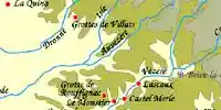
Go to the map of the local area around the cave in Clan of the Cave Bear
Allez à la carte de la Caverne du Clan en français
Go to the map of the Valley of Horses
Allez à la carte de la vallée des chevaux en français
Allez à la carte de Ukraine en français
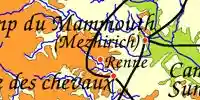
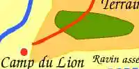
Go to the map of The Mammoth Hunters Lion Camp local area
Allez à la carte des chasseurs de mammouths en français
Go to the map of the Donau Mouth to First Snow from the Plains of Passage
Allez à la carte en français « de l'embouchure du Danube à première neige » d'après Le Grand Voyage
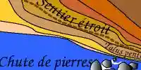
Go to the local map of the Sharamudoi / Iron Gates
Allez à la carte des Sharamudoi en français
Go to the map of First Snow to the Mammoths from the Plains of Passage
Allez à la carte en français de la première neige aux mammouths d'après le Grand Voyage
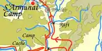
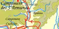
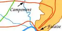
Go to the map of the Encounter with the S'Armunai
Allez à la carte en français de la rencontre avec les S'Armunaï
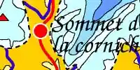
Go to the map of the Shelters of Stone - Zelandonii Territory
Allez à la carte de la Territoire des Zelandoni en français
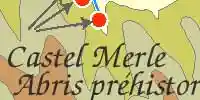
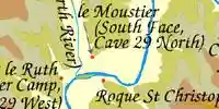
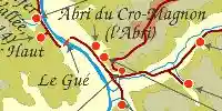
Go to the map of the Vézère Valley for students of archaeology
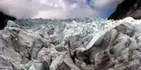 The Causes of the end of the last Ice Age: The last great ice age began around 120 000 years ago. One massive ice sheet, more than 3 kilometres thick in places, grew in fits and starts until it covered almost all of Canada and stretched down as far as Manhattan. Then, 20 000 years ago, a great thaw began. Over the following 10 000 years, the average global temperature rose by 3.5° C and most of the ice melted. Rising seas swallowed up low-lying areas such as the English Channel and North Sea, forcing our ancestors to abandon many settlements.
Go to the maps of the extent of the ice in the last ice age. A set of maps illustrate how the last British ice sheet shrunk during the Ice Age. The unique maps record the pattern and speed of shrinkage of the large ice sheet that covered the British Isles during the last Ice Age, approximately 20 000 years ago. The sheet, which subsumed most of Britain, Ireland and the North Sea, had an ice volume sufficient to raise global sea level by around 2.5 metres when it melted.

Go to the map of the Wurm and Riss Glaciation in the headwaters of the Donau (Danube)

Cartes dessinées à l’ordinateur

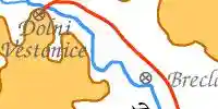
Dolni Vestonice and Pavlov - Jewellery, Pottery, and other artifacts
Dolni Vestonice and Pavlov Burials, including the triple burial
Südmären - Southern Moravia, a pictorial overview by Fritz Lange.