Also found in: Acronyms.
 uDig-1.1-RC14 | |
| Developer(s) | Refractions Research |
|---|---|
| Stable release | 1.4.0 / 24 March 2013 |
| Preview release | 1.2-RC3 |
| Repository | |
| Written in | Java |
| Operating system | Windows, Mac OS X, Linux |
| Type | Geographic information system |
| License | EPL + BSD |
| Website | http://udig.refractions.net/ |
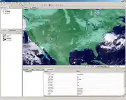
uDig is a GIS software program produced by a community led by Canadian-based consulting company Refractions Research. It is based on the Eclipse platform and features full layered Open Source GIS. It is written in Java and released under EPL and BSD licences (formerly under GNU LGPL).
uDig has a walkthrough in Flash and also quick start directions for those who wish to complete a full version build to write plug-ins or contribute to the main build.
uDig can use GRASS for complex vector operations and also embeds JGRASS and specialized hydrology tools from the Horton Machine. It supports shapefiles, PostGIS, WMS, and many other data sources natively.
uDig is commonly used as a framework for building other GIS platforms and applications. Such applications include DIVA-GIS and DEWS – Distant Early Warning System for tsunamis.
External links
This article is copied from an article on Wikipedia® - the free encyclopedia created and edited by its online user community. The text was not checked or edited by anyone on our staff. Although the vast majority of Wikipedia® encyclopedia articles provide accurate and timely information, please do not assume the accuracy of any particular article. This article is distributed under the terms of GNU Free Documentation License.