Also found in: Dictionary, Encyclopedia.
Sennar | |
|---|---|
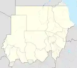
Sennar Location in Sudan | |
| Coordinates: 13°33′N 33°35′E / 13.550°N 33.583°E | |
| Country | |
| State | Sinnar State |
| Population (2007) | |
| • Total | 143,059 |
Sennar (Arabic: سنار Sannār) is a town on the Blue Nile in Sudan and capital of the state of Sennar. [1]For several centuries it was the capital of the Funj Kingdom of Sennar.
Overview
Sennar had an estimated population of 100,000 inhabitants in the early 19th century.[2] The modern town lies SSE of the ruins of the ancient capital of the Funj Kingdom, 300 kilometres (186 miles) southeast of Khartoum, the Capital of Sudan.
The city is home to Sinnar University, established in 1977.[3]
Climate
Sennar has a hot semi-arid climate (Köppen climate classification BSh).
| Climate data for Sennar (1961–1990, extremes 1907–present) | |||||||||||||
|---|---|---|---|---|---|---|---|---|---|---|---|---|---|
| Month | Jan | Feb | Mar | Apr | May | Jun | Jul | Aug | Sep | Oct | Nov | Dec | Year |
| Record high °C (°F) | 44.0 (111.2) | 45.9 (114.6) | 45.4 (113.7) | 47.0 (116.6) | 46.4 (115.5) | 46.5 (115.7) | 42.7 (108.9) | 41.5 (106.7) | 41.3 (106.3) | 42.0 (107.6) | 41.5 (106.7) | 40.3 (104.5) | 47.0 (116.6) |
| Average high °C (°F) | 33.5 (92.3) | 35.5 (95.9) | 38.9 (102.0) | 41.3 (106.3) | 41.1 (106.0) | 38.7 (101.7) | 35.2 (95.4) | 33.9 (93.0) | 35.3 (95.5) | 37.5 (99.5) | 36.4 (97.5) | 34.1 (93.4) | 36.8 (98.2) |
| Daily mean °C (°F) | 23.7 (74.7) | 25.5 (77.9) | 28.9 (84.0) | 31.3 (88.3) | 32.8 (91.0) | 31.5 (88.7) | 28.9 (84.0) | 28.0 (82.4) | 28.6 (83.5) | 29.9 (85.8) | 27.5 (81.5) | 28.6 (83.5) | 28.8 (83.8) |
| Average low °C (°F) | 14.0 (57.2) | 15.4 (59.7) | 19.0 (66.2) | 21.4 (70.5) | 21.5 (70.7) | 24.2 (75.6) | 22.7 (72.9) | 22.1 (71.8) | 21.9 (71.4) | 22.2 (72.0) | 18.6 (65.5) | 15.2 (59.4) | 19.9 (67.8) |
| Record low °C (°F) | 5.4 (41.7) | 5.7 (42.3) | 8.7 (47.7) | 10.0 (50.0) | 15.0 (59.0) | 16.7 (62.1) | 17.0 (62.6) | 17.6 (63.7) | 17.0 (62.6) | 14.7 (58.5) | 8.0 (46.4) | 4.7 (40.5) | 4.7 (40.5) |
| Average precipitation mm (inches) | 0.0 (0.0) | 0.0 (0.0) | 0.0 (0.0) | 0.0 (0.0) | 20.5 (0.81) | 66.1 (2.60) | 99.2 (3.91) | 135.9 (5.35) | 84.5 (3.33) | 13.7 (0.54) | 0.2 (0.01) | 0.0 (0.0) | 410.1 (16.15) |
| Average precipitation days (≥ 0.1 mm) | 0.0 | 0.0 | 0.0 | 0.0 | 3.2 | 5.7 | 9.0 | 9.6 | 6.3 | 2.6 | 0.0 | 0.0 | 36.4 |
| Average relative humidity (%) | 34 | 28 | 23 | 21 | 30 | 44 | 58 | 64 | 60 | 48 | 34 | 36 | 40 |
| Mean monthly sunshine hours | 319.3 | 285.6 | 306.9 | 303.0 | 294.5 | 249.0 | 217.0 | 226.3 | 249.0 | 285.2 | 309.0 | 313.1 | 3,357.9 |
| Percent possible sunshine | 91 | 87 | 82 | 81 | 76 | 66 | 54 | 59 | 69 | 78 | 91 | 90 | 77 |
| Source 1: NOAA[4] | |||||||||||||
| Source 2: Meteo Climat (record highs and lows)[5] | |||||||||||||
Demographics
| Year | Population |
|---|---|
| 1973 (Census) | 28,546 |
| 1983 (Census) | 42,803 |
| 1993 (Census) | 72,187 |
| 2007 (Estimate) | 143,059 |
See also
- Railway stations in Sudan
References
- ^ "Sudan tribune news site".
- ^ Walker, John (1810). "Sennar". The Universal Gazetteer. revised and improved by Arthur Kershaw (5th ed.). London: J. Johnson. OCLC 33422506.
- ^ "Sinar University". African Studies Center. Archived from the original on 2011-08-12. Retrieved 2011-09-17.
- ^ "Sennar Climate Normals 1961–1990". National Oceanic and Atmospheric Administration. Retrieved 22 October 2016.
- ^ "Station Sennar" (in French). Meteo Climat. Retrieved 22 October 2016.
External links
![]() Media related to Sennar (town) at Wikimedia Commons
Media related to Sennar (town) at Wikimedia Commons
This article is copied from an article on Wikipedia® - the free encyclopedia created and edited by its online user community. The text was not checked or edited by anyone on our staff. Although the vast majority of Wikipedia® encyclopedia articles provide accurate and timely information, please do not assume the accuracy of any particular article. This article is distributed under the terms of GNU Free Documentation License.