Westvoorne | |
|---|---|
Municipality | |
 Former city hall of Oostvoorne | |
Flag | |
.svg.gif) Location in South Holland | |
| Coordinates: 51°52′N 4°4′E / 51.867°N 4.067°E | |
| Country | Netherlands |
| Province | South Holland |
| Established | 1 January 1980 |
| Government | |
| • Body | Municipal council |
| • Mayor | Peter de Jong (PvdA) |
| Area | |
| • Total | 97.48 km2 (37.64 sq mi) |
| • Land | 53.18 km2 (20.53 sq mi) |
| • Water | 44.30 km2 (17.10 sq mi) |
| Elevation | 0 m (0 ft) |
| Population (January 2019)[4] | |
| • Total | 14,626 |
| • Density | 275/km2 (710/sq mi) |
| Time zone | UTC+1 (CET) |
| • Summer (DST) | UTC+2 (CEST) |
| Postcode | 3233–3235 |
| Area code | 0181 |
| Website | www |
Westvoorne (Dutch pronunciation: [ˈʋɛst ˌvoːrnə] ) is a municipality on the island Voorne-Putten in the western Netherlands, in the province of South Holland. The municipality covers an area of 97.48 km2 (37.64 sq mi) of which 44.30 km2 (17.10 sq mi) is water. It had a population of 14,626 in 2019.
The municipality of Westvoorne was formed on 1 January 1980, through the merger of the former municipalities of Oostvoorne and Rockanje.[5] It consists the population centres of Oostvoorne, Rockanje, Tinte and Helhoek.
Trivia
In 2011 Westvoorne has received the QualityCoast Gold Award for its efforts to become a sustainable tourism destination. Because of this award Westvoorne has been selected for inclusion in the global atlas for sustainable tourism DestiNet.[6]
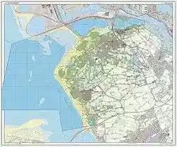
Dutch Topographic map of Westvoorne, July 2013
Notable people
- Jacob van Maerlant (ca.1230–40 – ca.1288–1300) Flemish poet of the 13th century, an important Middle Dutch author of the Middle Ages
- Volkert Simon Maarten van der Willigen (1822–1878) Dutch mathematician, physicist and professor
- Belinda Meuldijk (born 1955) Dutch actress, writer, and activist [7]
- Meindert van Buuren (born 1995) Dutch racing driver
Gallery
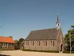
Tinte, chapel
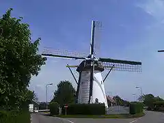
Rockanje, windmill

Tweede Slag, Rockanje. Oorlogsmonument in de duinen
References
- ^ "B&W leden" [Mayor and aldermen] (in Dutch). Gemeente Westvoorne. Retrieved 29 August 2013.
- ^ "Kerncijfers wijken en buurten 2020" [Key figures for neighbourhoods 2020]. StatLine (in Dutch). CBS. 24 July 2020. Retrieved 19 September 2020.
- ^ "Postcodetool for 3235AP". Actueel Hoogtebestand Nederland (in Dutch). Het Waterschapshuis. Retrieved 29 August 2013.
- ^ "Bevolkingsontwikkeling; regio per maand" [Population growth; regions per month]. CBS Statline (in Dutch). CBS. 1 January 2019. Retrieved 1 January 2019.
- ^ Ad van der Meer and Onno Boonstra, Repertorium van Nederlandse gemeenten, KNAW, 2011.
- ^ Sustainable Tourism Destination EUCC
- ^ IMDb Database retrieved 31 May 2019
External links
This article is copied from an article on Wikipedia® - the free encyclopedia created and edited by its online user community. The text was not checked or edited by anyone on our staff. Although the vast majority of Wikipedia® encyclopedia articles provide accurate and timely information, please do not assume the accuracy of any particular article. This article is distributed under the terms of GNU Free Documentation License.